Abstract
Disasters pose a significant threat to global development and poverty reduction. In developing communities, understanding disaster risk can be challenging in data-scarce environments. This research aims to transform disaster risk assessments by understanding how climate change will impact localised flood risk and unpack how these assessments can be better incorporated into local planning processes. The project team will accomplish this through in-depth study of two catchment basins located in the Municipality of Carigara (Leyte, Philippines) and the Regency of Singkil (Aceh, Indonesia). Hydrological modelling will incorporate downscaled climate change models, in combination with vulnerability assessments, to examine shifting flood risk patterns. We will use focus groups, key informant interviews, and serious games to develop a flood decision tool for local governments to better understand and apply flood climate models. Results will inform strategies to improve resilience of resource-constrained communities.
Project Team
- Dr Aaron Opdyke
- Ms Emily Nabong (The University of Sydney)
- Dr Ella Meilianda (Universitas Syiah Kuala)
- Mr Dedy Alfian (Universitas Syiah Kuala)
- Dr Yopi Ilhamsyah (Universitas Syiah Kuala)
- Dr Mahar Lagmay (University of the Philippines)
- Ms Joy Santiago (University of the Philippines)
- Mr Jerico Mendoza (University of the Philippines)
Funding
- Asia Pacific Network for Global Change Research Collaborative Regional Research Programme (USD 70,000)
Project Brief
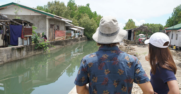
Floods continue to impact the largest number of people of any type of disaster globally, having affected more than two billion people over the last decade. Confounding these effects, climate change and urbanisation are making the nature of flood risk increasingly dynamic. This research aims to unpack these stressors, asking how climate change and urbanization will affect future flood risk of communities, contributing to the Sendai Framework’s target (g) to substantially increase the availability of and access disaster risk information and assessments to people by 2030.
A core issue in the operationalization of disaster risk reduction efforts is the ability to empirically define disaster risk. In the absence of quality risk assessments, local governments lack the data they need to make challenging decisions. The Intergovernmental Panel on Climate Change sensibly notes that risk identification is a prerequisite step for risk reduction, prevention, and climate adaptation in the context of extremes. This project aims to develop guidance on appropriate methods of incorporating climate change and future urbanization into flood modelling and risk estimation, as well as to understand how and why risk information is given legitimacy in local planning processes and unpack how these current adoption processes can be leveraged to increase the uptake of risk assessments in local planning. With these aims in mind, the project’s specific objectives include:
1. Ensure targeted local governments have access to flood risk assessments that incorporate climate change and urbanisation projects
1.1. Gather updated land use and infrastructure assets in each of the target sites
1.2. Produce hydrological models that incorporate climate change for local contexts for the study sites
1.3. Produce household vulnerability profiles
1.4. Integrate the earlier outputs into a single model that spatially depicts flood risk for communities through both visual and numerical tools
2. Mobilise DRR/CCA knowledge in planning in targeted local governments
2.1. Identify a list of DRR/CCA knowledge mobilisation strategies for local governments
2.2. Develop a serious game activity to identify planning trade-offs
The proposed research activity will occur in close partnership with local governments to ensure that the research translates to policy action. Beyond just modelling, the research will also incorporate an action research component with policymakers to understand local knowledge legitimation processes to enhance the adoption of risk reduction strategies. Through learning exchanges, the team will connect not only researchers but also local policymakers across the two selected study sites. The team will also leverage existing connections with national government agencies in the two selected contexts to use the selected sites as cases to engage with national policy.
The overall objective of this project seeks to support local governments in developing urban communities to incorporate climate change into flood risk assessments and mobilise knowledge to realise resilient and sustainable development. As a result of better understanding the influence of climate change on flood risk, local governments and communities can make more informed decisions on their development pathways. Increased access to flood risk assessments that forecast future changes will serve to not only reduce risk, but also prevent the creation of new risk – a growing concern. This knowledge holds potential to save lives and prevent economic losses. The project will also seek to synthesise appropriate and simplified methods that can be used to create best practice on integrating climate change into flood models. Exchange of lessons from across the selected contexts will also create understanding of how risk assessments can be mainstreamed across local government development efforts. Importantly, our approach seeks to interrogate how local governments value, use, and understand climate change models. This complimentary objective seeks to ensure that the intersection of local and scientific knowledge results in policy action for local communities.